 vesseltracker.com
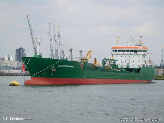
 Thun Lidkoping
Current Status
Where is the vessel?
Thun Lidkoping is currently in 24 nm NW of Saint David's, based on AIS data received about 16h ago.
Latest AIS update:
Current position: 52.12100° N, 5.79402° W (24 nm NW of Saint David's)
Average speed (last 7 days): Loading…
Average speed (last 30 days): Loading…
Vessel profile: Thun Lidkoping is a Chemical Tanker with dimensions 150m x 22m.
This page combines live AIS, route history, probable destination signals, nearby traffic, and port activity for practical vessel monitoring.
The current position of vessel Thun Lidkoping is 52.12100 lat / -5.79402 lng. Updated: 2026-05-18 01:32:43 UTCNearest reference points:
- Near WEXFORD
- Near ARKLOW
- Near WICKLOW
Currently sailing under the flag of Netherlands ![]()
Details:
Live Vessel Thun Lidkoping Analytics (details, animations, etc.)
Recent AIS points (UTC):
2026-05-17 22:17:17 UTC · 51.64532, -5.66334 · SOG 11.5 kn · COG 267°2026-05-17 22:44:08 UTC · 51.64716, -5.79896 · SOG 11.2 kn · COG 275°
2026-05-18 01:31:18 UTC · 52.11725, -5.79353 · SOG 9.6 kn · COG 0°
2026-05-18 01:32:43 UTC · 52.12100, -5.79402 · SOG 9.6 kn · COG 1°