 Takaoki Maru
Current Status
Where is the vessel?
Takaoki Maru is currently in 26 nm S of KANNOURA, based on AIS data received about 14h ago.
Latest AIS update:
Current position: 33.11833° N, 134.20500° E (26 nm S of KANNOURA)
Average speed (last 7 days): Loading…
Average speed (last 30 days): Loading…
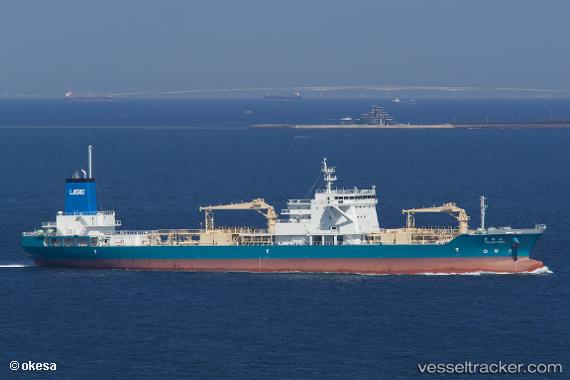
Vessel profile: Takaoki Maru is a Cement Carrier with dimensions 158m x 24m.
This page combines live AIS, route history, probable destination signals, nearby traffic, and port activity for practical vessel monitoring.
The current position of vessel Takaoki Maru is 33.11833 lat / 134.20500 lng. Updated: 2026-05-20 01:44:33 UTCNearest reference points:
- Near Kochi
- Near TOKUSHIMA
- 40 nm SW of Minachi
Currently sailing under the flag of Japan ![]()
Details:
Live Vessel Takaoki Maru Analytics (details, animations, etc.)
Recent AIS points (UTC):
2026-05-19 22:17:30 UTC · 32.77500, 133.29666 · SOG 13 kn · COG -1°2026-05-20 00:14:32 UTC · 32.98000, 133.79500 · SOG 14 kn · COG -1°
2026-05-20 01:17:37 UTC · 33.07833, 134.07832 · SOG 14 kn · COG -1°
2026-05-20 01:44:33 UTC · 33.11833, 134.20500 · SOG 15 kn · COG -1°