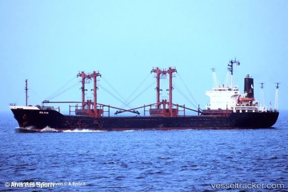
Mohammed Bey
Current StatusWhere is the vessel?
Mohammed Bey is currently in Near Tripoli, based on AIS data received about 1d ago.
Latest AIS update:
Current position: 34.45207° N, 35.82048° E (Near Tripoli)
Average speed (last 7 days): Loading…
Average speed (last 30 days): Loading…
Vessel profile: Mohammed Bey is a General Cargo Ship with dimensions 20m x 119m.
This page combines live AIS, route history, probable destination signals, nearby traffic, and port activity for practical vessel monitoring.
The current position of vessel Mohammed Bey is 34.45207 lat / 35.82048 lng. Updated: 2026-05-21 07:36:55 UTCNearest reference points:
- Near Tripoli
- Near Tartous
- Near Zouk
Details:
Live Vessel Mohammed Bey Analytics (details, animations, etc.)
Recent AIS points (UTC):
2026-05-21 07:36:55 UTC · 34.45207, 35.82048 · SOG 0.1 kn · COG -1°2026-05-21 07:36:55 UTC · 34.45207, 35.82048 · SOG 0.1 kn · COG -1°
2026-05-21 07:36:55 UTC · 34.45207, 35.82048 · SOG 0.1 kn · COG -1°
2026-05-21 07:36:55 UTC · 34.45207, 35.82048 · SOG 0.1 kn · COG -1°