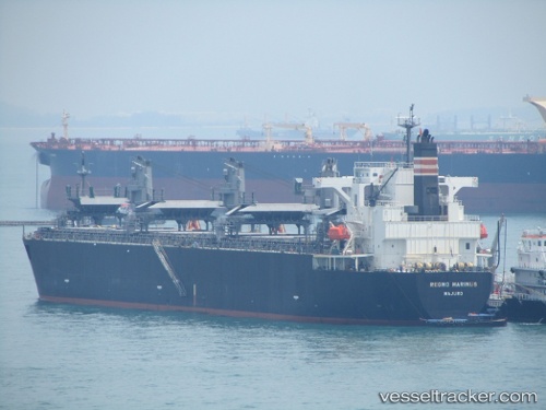
Regno Marinus
Current StatusWhere is the vessel?
Regno Marinus is currently in 39 nm E of Utiel, based on AIS data received about 14h ago.
Latest AIS update:
Current position: 39.62140° N, 10.31594° W (39 nm E of Utiel)
Average speed (last 7 days): Loading…
Average speed (last 30 days): Loading…
Vessel profile: Regno Marinus is a Wood Chips Carrier with dimensions 32m x 210m.
This page combines live AIS, route history, probable destination signals, nearby traffic, and port activity for practical vessel monitoring.
The current position of vessel Regno Marinus is 39.62140 lat / -10.31594 lng. Updated: 2026-05-22 01:22:22 UTCNearest reference points:
- 18 nm W of Colares
- Near PENICHE
- 52 nm W of Canas de Santa Maria
Details:
Live Vessel Regno Marinus Analytics (details, animations, etc.)
Recent AIS points (UTC):
2026-05-21 19:56:12 UTC · 40.44524, -9.51567 · SOG 11 kn · COG 218°2026-05-21 22:06:12 UTC · 40.13181, -9.85448 · SOG 11.2 kn · COG 216°
2026-05-21 22:24:13 UTC · 40.08645, -9.90090 · SOG 11.8 kn · COG 221°
2026-05-22 01:22:22 UTC · 39.62140, -10.31594 · SOG 11.7 kn · COG 205°