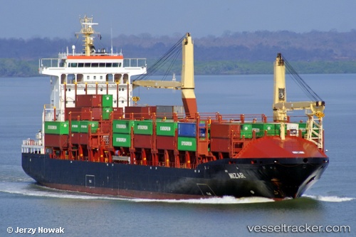
 MIZAR
MIZAR
Current Status
Where is the vessel?
MIZAR is currently in Near Puerto Barrios, based on AIS data received about 14h ago.
Latest AIS update:
Current position: 15.82500° N, 88.58500° W (Near Puerto Barrios)
Average speed (last 7 days): Loading…
Average speed (last 30 days): Loading…
Vessel profile: MIZAR is a Container Ship with dimensions 26m x 162m.
This page combines live AIS, route history, probable destination signals, nearby traffic, and port activity for practical vessel monitoring.
The current position of vessel MIZAR is 15.82500 lat / -88.58500 lng. Updated: 2026-05-21 10:42:19 UTCNearest reference points:
- 14 nm NW of Puerto Cortes
- 12 nm SW of Dangriga
- 26 nm SE of Dangriga
Currently sailing under the flag of Liberia ![]()
MIZAR built in 2005 year
Deadweight:
17350 tDetails:
Live Vessel MIZAR Analytics (details, animations, etc.)
Recent AIS points (UTC):
2026-05-21 07:30:17 UTC · 15.82167, -88.58667 · SOG 0 kn · COG -1°2026-05-21 08:00:17 UTC · 15.82333, -88.58667 · SOG 0 kn · COG -1°
2026-05-21 09:36:17 UTC · 15.82500, -88.58500 · SOG 0 kn · COG -1°
2026-05-21 10:42:19 UTC · 15.82500, -88.58500 · SOG 0 kn · COG -1°