 COVE PEARL
Current Status
Where is the vessel?
COVE PEARL is currently in Near Corinto, based on AIS data received about 14h ago.
Latest AIS update:
Current position: 12.47565° N, 87.17338° W (Near Corinto)
Average speed (last 7 days): Loading…
Average speed (last 30 days): Loading…
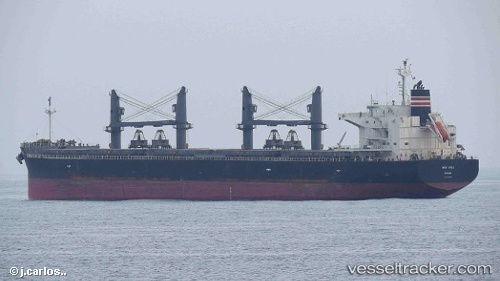
Vessel profile: COVE PEARL is a General Cargo Ship with dimensions 190m x 32m.
This page combines live AIS, route history, probable destination signals, nearby traffic, and port activity for practical vessel monitoring.
The current position of vessel COVE PEARL is 12.47565 lat / -87.17338 lng. Updated: 2026-05-19 13:55:39 UTCNearest reference points:
- Near El Salvador
- 27 nm W of Playa Conchal
- Near Golfo de Papagayo
Currently sailing under the flag of Bahamas ![]()
COVE PEARL built in 2014 year
Deadweight:
55889 tDetails:
Live Vessel COVE PEARL Analytics (details, animations, etc.)
Recent AIS points (UTC):
2026-05-19 10:40:39 UTC · 12.47572, -87.17335 · SOG 0 kn · COG 71°2026-05-19 11:19:39 UTC · 12.47573, -87.17337 · SOG 0 kn · COG 71°
2026-05-19 13:40:39 UTC · 12.47570, -87.17335 · SOG 0 kn · COG 71°
2026-05-19 13:55:39 UTC · 12.47565, -87.17338 · SOG 0.1 kn · COG 71°