 vesseltracker.com
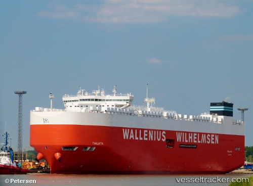
 Thalatta
Current Status
Where is the vessel?
Thalatta is currently in 17 nm W of HITAKATSU, based on AIS data received about 14h ago.
Latest AIS update:
Current position: 34.60001° N, 129.14427° E (17 nm W of HITAKATSU)
Average speed (last 7 days): Loading…
Average speed (last 30 days): Loading…
Vessel profile: Thalatta is a Vehicles Carrier with dimensions 200m x 37m.
This page combines live AIS, route history, probable destination signals, nearby traffic, and port activity for practical vessel monitoring.
The current position of vessel Thalatta is 34.60001 lat / 129.14427 lng. Updated: 2026-05-18 04:25:00 UTCNearest reference points:
- 20 nm W of HITAKATSU
- 15 nm E of OKPO
- Near OKPO
Currently sailing under the flag of Malta ![]()
Details:
Live Vessel Thalatta Analytics (details, animations, etc.)
Recent AIS points (UTC):
2026-05-18 01:41:11 UTC · 34.17429, 128.89299 · SOG 10.6 kn · COG 18°2026-05-18 01:42:39 UTC · 34.17830, 128.89520 · SOG 10.6 kn · COG 18°
2026-05-18 03:26:11 UTC · 34.44437, 129.06206 · SOG 10.4 kn · COG 25°
2026-05-18 04:25:00 UTC · 34.60001, 129.14427 · SOG 10.5 kn · COG 12°