 British Achiever
Current Status
Where is the vessel?
British Achiever is currently in Open sea, approx. 428 nm off the nearest listed port, based on AIS data received about 14h ago.
Latest AIS update:
Current position: 11.22490° S, 58.53762° E (Open sea, approx. 428 nm off the nearest listed port)
Average speed (last 7 days): Loading…
Average speed (last 30 days): Loading…
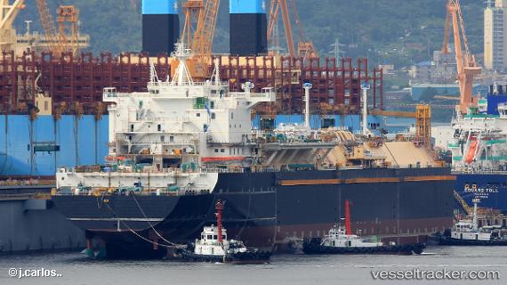
Vessel profile: British Achiever is a Lng Tanker with dimensions 295m x 46m.
This page combines live AIS, route history, probable destination signals, nearby traffic, and port activity for practical vessel monitoring.
The current position of vessel British Achiever is -11.22490 lat / 58.53762 lng. Updated: 2026-05-20 14:10:42 UTCNearest reference points:
- Open sea, approx. 428 nm off the nearest listed port
- Open sea, approx. 426 nm off the nearest listed port
- Open sea, approx. 437 nm off the nearest listed port
Currently sailing under the flag of United Kingdom ![]()
Details:
Live Vessel British Achiever Analytics (details, animations, etc.)
Recent AIS points (UTC):
2026-05-20 10:21:29 UTC · -12.33001, 58.09721 · SOG 18.9 kn · COG 23°2026-05-20 12:07:09 UTC · -11.82183, 58.29972 · SOG 18.5 kn · COG 25°
2026-05-20 13:55:36 UTC · -11.29817, 58.50833 · SOG 18.5 kn · COG 26°
2026-05-20 14:10:42 UTC · -11.22490, 58.53762 · SOG 19 kn · COG 23°