 vesseltracker.com
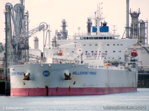
 Hellespont Promise
Current Status
Where is the vessel?
Hellespont Promise is currently in 91 nm E of Tampico, based on AIS data received about 14h ago.
Latest AIS update:
Current position: 22.63847° N, 95.48205° W (91 nm E of Tampico)
Average speed (last 7 days): Loading…
Average speed (last 30 days): Loading…
Vessel profile: Hellespont Promise is a Crude Oil Tanker with dimensions 228m x 228m.
This page combines live AIS, route history, probable destination signals, nearby traffic, and port activity for practical vessel monitoring.
The current position of vessel Hellespont Promise is 22.63847 lat / -95.48205 lng. Updated: 2026-05-18 10:06:53 UTCNearest reference points:
- 25 nm E of Tuxpan
Currently sailing under the flag of United Kingdom ![]()
Hellespont Promise built in 2007 year
Deadweight:
73669 tDetails:
Live Vessel Hellespont Promise Analytics (details, animations, etc.)
Recent AIS points (UTC):
2026-05-18 03:53:32 UTC · 22.74515, -94.02940 · SOG 12.9 kn · COG 264°2026-05-18 07:21:06 UTC · 22.68110, -94.82347 · SOG 12.8 kn · COG 267°
2026-05-18 07:43:11 UTC · 22.67520, -94.90965 · SOG 13 kn · COG 267°
2026-05-18 10:06:53 UTC · 22.63847, -95.48205 · SOG 13.3 kn · COG 264°