 Nahlin
Current Status
Where is the vessel?
Nahlin is currently in Near Tarragona, based on AIS data received about 15h ago.
Latest AIS update:
Current position: 41.10927° N, 1.24335° E (Near Tarragona)
Average speed (last 7 days): Loading…
Average speed (last 30 days): Loading…
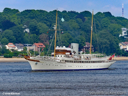
Vessel profile: Nahlin is a Yacht with dimensions 94m x 12m.
This page combines live AIS, route history, probable destination signals, nearby traffic, and port activity for practical vessel monitoring.
The current position of vessel Nahlin is 41.10927 lat / 1.24335 lng. Updated: 2026-05-23 05:26:51 UTCNearest reference points:
- Near Tarragona
- Near Salou
- Near CAMBRILS
Currently sailing under the flag of United Kingdom ![]()
Nahlin built in 1930 year
Deadweight:
1574 tDetails:
Live Vessel Nahlin Analytics (details, animations, etc.)
Recent AIS points (UTC):
2026-05-23 01:56:50 UTC · 41.10927, 1.24335 · SOG 0 kn · COG 193°2026-05-23 04:11:52 UTC · 41.10926, 1.24334 · SOG 0 kn · COG 193°
2026-05-23 04:23:52 UTC · 41.10927, 1.24334 · SOG 0 kn · COG 193°
2026-05-23 05:26:51 UTC · 41.10927, 1.24335 · SOG 0 kn · COG 193°