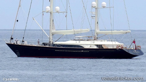
Fidelis
Current StatusWhere is the vessel?
Fidelis is currently in Near MAOLO LAILAI, based on AIS data received about 14h ago.
Latest AIS update:
Current position: 17.75968° S, 177.19884° E (Near MAOLO LAILAI)
Average speed (last 7 days): Loading…
Average speed (last 30 days): Loading…
Vessel profile: Fidelis is a Service Ship with dimensions 12m x 56m.
This page combines live AIS, route history, probable destination signals, nearby traffic, and port activity for practical vessel monitoring.
The current position of vessel Fidelis is -17.75968 lat / 177.19884 lng. Updated: 2026-05-20 10:11:06 UTCNearest reference points:
- Near DENARAU
- Near Denarau
- Near Suva
Details:
Live Vessel Fidelis Analytics (details, animations, etc.)
Recent AIS points (UTC):
2026-05-20 07:26:04 UTC · -17.75956, 177.19905 · SOG 0.2 kn · COG 172°2026-05-20 08:19:17 UTC · -17.75833, 177.19833 · SOG 0 kn · COG -1°
2026-05-20 09:35:07 UTC · -17.75969, 177.19879 · SOG 0.5 kn · COG 48°
2026-05-20 10:11:06 UTC · -17.75968, 177.19884 · SOG 0.3 kn · COG 214°