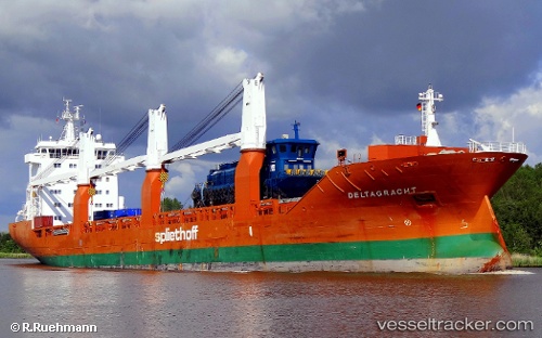
 Deltagracht
Current Status
Where is the vessel?
Deltagracht is currently in 14 nm W of Haring, based on AIS data received about 14h ago.
Latest AIS update:
Current position: 41.44467° N, 11.80898° E (14 nm W of Haring)
Average speed (last 7 days): Loading…
Average speed (last 30 days): Loading…
Vessel profile: Deltagracht is a General Cargo Ship with dimensions 157m x 23m.
This page combines live AIS, route history, probable destination signals, nearby traffic, and port activity for practical vessel monitoring.
The current position of vessel Deltagracht is 41.44467 lat / 11.80898 lng. Updated: 2026-05-18 22:58:08 UTCNearest reference points:
- Near Fiumicino
- Near Santa Marinella
- Near Torvaianica
Currently sailing under the flag of Netherlands ![]()
Deltagracht built in 2009 year
Deadweight:
18143 tDetails:
Live Vessel Deltagracht Analytics (details, animations, etc.)
Recent AIS points (UTC):
2026-05-18 19:11:57 UTC · 42.17036, 10.89730 · SOG 16.2 kn · COG 137°2026-05-18 20:18:47 UTC · 41.95551, 11.17510 · SOG 16.2 kn · COG 136°
2026-05-18 21:41:10 UTC · 41.68500, 11.50833 · SOG 15 kn · COG -1°
2026-05-18 22:58:08 UTC · 41.44467, 11.80898 · SOG 15.7 kn · COG 130°