 Manisa Kate
Current Status
Where is the vessel?
Manisa Kate is currently in 10 nm SE of PALAMOS, based on AIS data received about 14h ago.
Latest AIS update:
Current position: 41.69672° N, 3.24302° E (10 nm SE of PALAMOS)
Average speed (last 7 days): Loading…
Average speed (last 30 days): Loading…
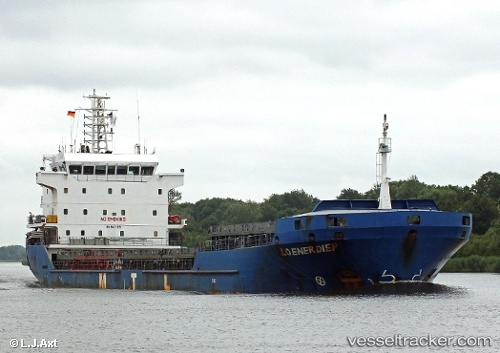
Vessel profile: Manisa Kate is a Multi Purpose Carrier with dimensions 108m x 18m.
This page combines live AIS, route history, probable destination signals, nearby traffic, and port activity for practical vessel monitoring.
The current position of vessel Manisa Kate is 41.69672 lat / 3.24302 lng. Updated: 2026-05-21 22:10:27 UTCNearest reference points:
- Near L'ESTARTIT
- 13 nm E of L'ESTARTIT
- Near PORT BALIS
Currently sailing under the flag of Netherlands ![]()
Manisa Kate built in 2008 year
Deadweight:
8100 tDetails:
Live Vessel Manisa Kate Analytics (details, animations, etc.)
Recent AIS points (UTC):
2026-05-21 19:52:38 UTC · 42.03399, 3.42257 · SOG 9.7 kn · COG 186°2026-05-21 20:13:48 UTC · 41.97671, 3.41465 · SOG 9.8 kn · COG 186°
2026-05-21 21:53:38 UTC · 41.73380, 3.27856 · SOG 9.6 kn · COG 217°
2026-05-21 22:10:27 UTC · 41.69672, 3.24302 · SOG 9.8 kn · COG 217°