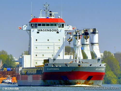
Atlanticborg
Current StatusWhere is the vessel?
Atlanticborg is currently in 16 nm S of Hausvikstrand, based on AIS data received about 14h ago.
Latest AIS update:
Current position: 57.76475° N, 6.91881° E (16 nm S of Hausvikstrand)
Average speed (last 7 days): Loading…
Average speed (last 30 days): Loading…
Vessel profile: Atlanticborg is a General Cargo Ship with dimensions 22m x 143m.
This page combines live AIS, route history, probable destination signals, nearby traffic, and port activity for practical vessel monitoring.
The current position of vessel Atlanticborg is 57.76475 lat / 6.91881 lng. Updated: 2026-05-19 10:28:06 UTCNearest reference points:
- Near Kirkehamn
- Near Åna-Sira
- Near Kristiansand
Details:
Live Vessel Atlanticborg Analytics (details, animations, etc.)
Recent AIS points (UTC):
2026-05-19 07:55:37 UTC · 57.75611, 7.82873 · SOG 11.6 kn · COG 261°2026-05-19 08:04:46 UTC · 57.75263, 7.77402 · SOG 11.6 kn · COG 264°
2026-05-19 10:07:14 UTC · 57.76098, 7.04089 · SOG 11.2 kn · COG 269°
2026-05-19 10:28:06 UTC · 57.76475, 6.91881 · SOG 11.2 kn · COG 268°