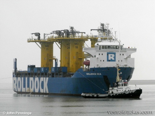
 Rolldock Sea
Current Status
Where is the vessel?
Rolldock Sea is currently in 30 nm N of USTKA, based on AIS data received about 14h ago.
Latest AIS update:
Current position: 55.08049° N, 16.71854° E (30 nm N of USTKA)
Average speed (last 7 days): Loading…
Average speed (last 30 days): Loading…
Vessel profile: Rolldock Sea is a Heavy Load Carrier with dimensions 139m x 24m.
This page combines live AIS, route history, probable destination signals, nearby traffic, and port activity for practical vessel monitoring.
The current position of vessel Rolldock Sea is 55.08049 lat / 16.71854 lng. Updated: 2026-05-21 04:00:42 UTCNearest reference points:
- 31 nm NW of Ustka
- Near KOLOBRZEG
- Near Karlskrona
Currently sailing under the flag of Netherlands ![]()
Rolldock Sea built in 2011 year
Deadweight:
6879 tDetails:
Live Vessel Rolldock Sea Analytics (details, animations, etc.)
Recent AIS points (UTC):
2026-05-20 23:24:43 UTC · 55.08041, 16.71756 · SOG 0.1 kn · COG 68°2026-05-21 01:24:43 UTC · 55.08013, 16.71808 · SOG 0 kn · COG 19°
2026-05-21 01:42:42 UTC · 55.08012, 16.71824 · SOG 0 kn · COG 6°
2026-05-21 04:00:42 UTC · 55.08049, 16.71854 · SOG 0 kn · COG 62°