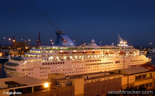
 MAJESTY
Current Status
Where is the vessel?
MAJESTY is currently in 175 nm SW of Okha, based on AIS data received about 14h ago.
Latest AIS update:
Current position: 21.31176° N, 66.20562° E (175 nm SW of Okha)
Average speed (last 7 days): Loading…
Average speed (last 30 days): Loading…
Vessel profile: MAJESTY is a Passengers Ship with dimensions m x m.
This page combines live AIS, route history, probable destination signals, nearby traffic, and port activity for practical vessel monitoring.
The current position of vessel MAJESTY is 21.31176 lat / 66.20562 lng. Updated: 2026-05-22 10:09:50 UTCNearest reference points:
- 231 nm SW of Keti Bandar
- 84 nm SW of Keti Bandar
- 147 nm SW of Kiamari
Currently sailing under the flag of Malta ![]()
Details:
Live Vessel MAJESTY Analytics (details, animations, etc.)
Recent AIS points (UTC):
2026-05-22 07:39:51 UTC · 21.18246, 65.69285 · SOG 11.8 kn · COG 72°2026-05-22 08:03:21 UTC · 21.20208, 65.77276 · SOG 11.8 kn · COG 72°
2026-05-22 09:39:50 UTC · 21.28516, 66.10301 · SOG 12.2 kn · COG 73°
2026-05-22 10:09:50 UTC · 21.31176, 66.20562 · SOG 11.8 kn · COG 73°