 vesseltracker.com
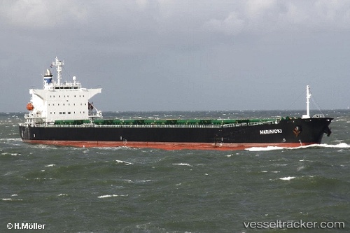
Marinicki
Current StatusWhere is the vessel?
Marinicki is currently in Near WAILINGDING ISLAND, based on AIS data received about 15h ago.
Latest AIS update:
Current position: 21.95440° N, 113.94873° E (Near WAILINGDING ISLAND)
Average speed (last 7 days): Loading…
Average speed (last 30 days): Loading…
Vessel profile: Marinicki is a Bulk Carrier with dimensions 32m x 225m.
This page combines live AIS, route history, probable destination signals, nearby traffic, and port activity for practical vessel monitoring.
The current position of vessel Marinicki is 21.95440 lat / 113.94873 lng. Updated: 2026-05-17 22:10:35 UTCNearest reference points:
- Near WAILINGDING ISLAND
- 15 nm S of WAILINGDING ISLAND
- 14 nm SE of Wanshan Pt
Details:
Live Vessel Marinicki Analytics (details, animations, etc.)
Recent AIS points (UTC):
2026-05-17 19:16:32 UTC · 21.95435, 113.94872 · SOG 0.1 kn · COG 94°2026-05-17 19:46:35 UTC · 21.95465, 113.94867 · SOG 0 kn · COG 100°
2026-05-17 22:04:35 UTC · 21.95450, 113.94868 · SOG 0 kn · COG 99°
2026-05-17 22:10:35 UTC · 21.95440, 113.94873 · SOG 0.1 kn · COG 99°