 B Gas Margrethe
Current Status
Where is the vessel?
B Gas Margrethe is currently in 10 nm SW of Fedje, based on AIS data received about 14h ago.
Latest AIS update:
Current position: 60.67044° N, 4.42004° E (10 nm SW of Fedje)
Average speed (last 7 days): Loading…
Average speed (last 30 days): Loading…
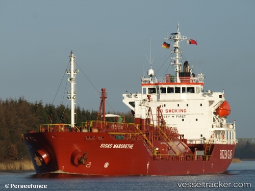
Vessel profile: B Gas Margrethe is a Lpg Tanker with dimensions 100m x 17m.
This page combines live AIS, route history, probable destination signals, nearby traffic, and port activity for practical vessel monitoring.
The current position of vessel B Gas Margrethe is 60.67044 lat / 4.42004 lng. Updated: 2026-05-22 04:23:06 UTCNearest reference points:
- Near Solund
- Near Eivindvik
- Near Glesvær
Currently sailing under the flag of Malta ![]()
B Gas Margrethe built in 2006 year
Deadweight:
4970 tDetails:
Live Vessel B Gas Margrethe Analytics (details, animations, etc.)
Recent AIS points (UTC):
2026-05-22 01:27:16 UTC · 60.22125, 4.22743 · SOG 13.9 kn · COG 3°2026-05-22 02:08:05 UTC · 60.37646, 4.25874 · SOG 13.7 kn · COG 5°
2026-05-22 04:07:48 UTC · 60.66794, 4.45719 · SOG 5 kn · COG 259°
2026-05-22 04:23:06 UTC · 60.67044, 4.42004 · SOG 1.5 kn · COG 244°