 SEA PROSPECT
Current Status
Where is the vessel?
SEA PROSPECT is currently in 62 nm NE of Boboras, based on AIS data received about 14h ago.
Latest AIS update:
Current position: 47.20667° N, 7.12667° W (62 nm NE of Boboras)
Average speed (last 7 days): Loading…
Average speed (last 30 days): Loading…
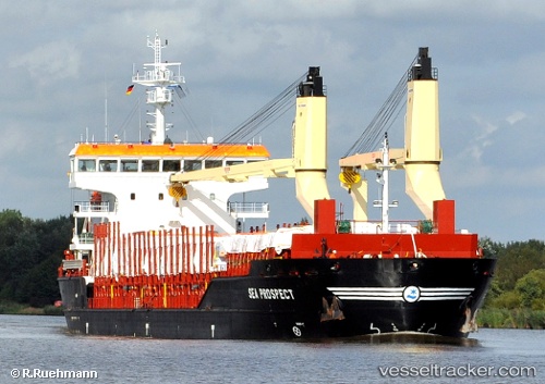
Vessel profile: SEA PROSPECT is a General Cargo with dimensions m x m.
This page combines live AIS, route history, probable destination signals, nearby traffic, and port activity for practical vessel monitoring.
The current position of vessel SEA PROSPECT is 47.20667 lat / -7.12667 lng. Updated: 2026-05-22 23:46:39 UTCNearest reference points:
- 58 nm SE of Rietheim-Weilheim
- 60 nm SE of San Clodio
- 46 nm W of SEIN
Currently sailing under the flag of Portugal ![]()
Details:
Live Vessel SEA PROSPECT Analytics (details, animations, etc.)
Recent AIS points (UTC):
2026-05-22 20:18:33 UTC · 47.75224, -6.68377 · SOG 10.6 kn · COG -1°2026-05-22 22:13:55 UTC · 47.44548, -6.93239 · SOG 10.3 kn · COG 209°
2026-05-22 22:31:24 UTC · 47.40179, -6.96882 · SOG 10 kn · COG 212°
2026-05-22 23:46:39 UTC · 47.20667, -7.12667 · SOG 10 kn · COG -1°