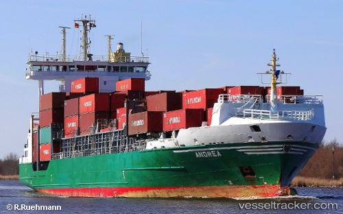
 ANDREA
Current Status
Where is the vessel?
ANDREA is currently in 10 nm NW of Aveiro, based on AIS data received about 14h ago.
Latest AIS update:
Current position: 40.77502° N, 8.95349° W (10 nm NW of Aveiro)
Average speed (last 7 days): Loading…
Average speed (last 30 days): Loading…
Vessel profile: ANDREA is a Container Ship with dimensions m x m.
This page combines live AIS, route history, probable destination signals, nearby traffic, and port activity for practical vessel monitoring.
The current position of vessel ANDREA is 40.77502 lat / -8.95349 lng. Updated: 2026-05-20 01:56:07 UTCNearest reference points:
- Near Gafanha da Nazaré
- Near Matosinhos
- Near POVOA DE VARZIM
Currently sailing under the flag of Portugal ![]()
Details:
Live Vessel ANDREA Analytics (details, animations, etc.)
Recent AIS points (UTC):
2026-05-19 23:05:16 UTC · 41.19388, -8.68472 · SOG 0 kn · COG 232°2026-05-20 00:10:48 UTC · 41.07624, -8.77078 · SOG 11.2 kn · COG 212°
2026-05-20 01:14:27 UTC · 40.89632, -8.88455 · SOG 11.2 kn · COG 202°
2026-05-20 01:56:07 UTC · 40.77502, -8.95349 · SOG 11.4 kn · COG 203°