 WILFORCE
Current Status
Where is the vessel?
WILFORCE is currently in 67 nm S of Phuket Port, based on AIS data received about 14h ago.
Latest AIS update:
Current position: 6.69910° N, 98.29569° E (67 nm S of Phuket Port)
Average speed (last 7 days): Loading…
Average speed (last 30 days): Loading…
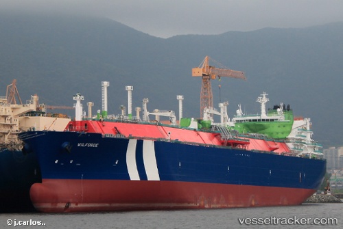
Vessel profile: WILFORCE is a Lng Tanker with dimensions m x m.
This page combines live AIS, route history, probable destination signals, nearby traffic, and port activity for practical vessel monitoring.
The current position of vessel WILFORCE is 6.69910 lat / 98.29569 lng. Updated: 2026-05-22 03:21:13 UTCNearest reference points:
- 45 nm N of Langsa Venture FPSO
- 34 nm N of Langsa Venture FPSO
- 29 nm W of Ban Kantang
Currently sailing under the flag of Malta ![]()
Details:
Live Vessel WILFORCE Analytics (details, animations, etc.)
Recent AIS points (UTC):
2026-05-21 22:59:56 UTC · 6.66298, 98.22225 · SOG 1.1 kn · COG -1°2026-05-22 01:32:29 UTC · 6.68262, 98.26462 · SOG 1.1 kn · COG 356°
2026-05-22 01:35:47 UTC · 6.68235, 98.26409 · SOG 1.1 kn · COG -1°
2026-05-22 03:21:13 UTC · 6.69910, 98.29569 · SOG 1.1 kn · COG 355°