 vesseltracker.com
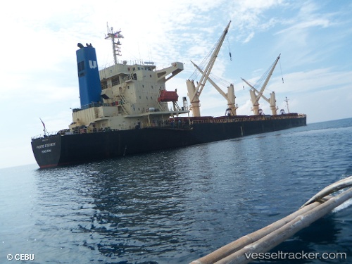
 SANITA S
Current Status
Where is the vessel?
SANITA S is currently in Open sea (no nearby ports in database), based on AIS data received about 14h ago.
Latest AIS update:
Current position: 14.12948° S, 1.38916° E (Open sea (no nearby ports in database))
Average speed (last 7 days): Loading…
Average speed (last 30 days): Loading…
Vessel profile: SANITA S is a Bulk Carrier with dimensions m x m.
This page combines live AIS, route history, probable destination signals, nearby traffic, and port activity for practical vessel monitoring.
The current position of vessel SANITA S is -14.12948 lat / 1.38916 lng. Updated: 2026-05-18 02:13:58 UTCNearest reference points:
- Open sea (no nearby ports in database)
Currently sailing under the flag of Turkey ![]()
SANITA S built in 2004 year
Deadweight:
46683 tDetails:
Live Vessel SANITA S Analytics (details, animations, etc.)
Recent AIS points (UTC):
2026-05-17 22:44:28 UTC · -13.63872, 1.01233 · SOG 10.4 kn · COG 143°2026-05-17 23:19:59 UTC · -13.72133, 1.07858 · SOG 10.4 kn · COG 141°
2026-05-18 01:36:30 UTC · -14.04016, 1.32350 · SOG 10.2 kn · COG 145°
2026-05-18 02:13:58 UTC · -14.12948, 1.38916 · SOG 10.7 kn · COG 143°