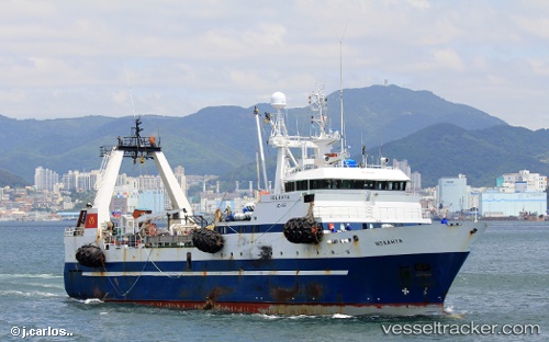
 IOLANTA
Current Status
Where is the vessel?
IOLANTA is currently in Near Preobrazheniye, based on AIS data received about 14h ago.
Latest AIS update:
Current position: 42.89780° N, 133.89490° E (Near Preobrazheniye)
Average speed (last 7 days): Loading…
Average speed (last 30 days): Loading…
Vessel profile: IOLANTA is a Fishing Vessel with dimensions 64m x 13m.
This page combines live AIS, route history, probable destination signals, nearby traffic, and port activity for practical vessel monitoring.
The current position of vessel IOLANTA is 42.89780 lat / 133.89490 lng. Updated: 2026-05-21 09:40:16 UTCNearest reference points:
- 15 nm SW of Preobrazheniye
- 17 nm SW of Preobrazheniye
- 16 nm E of Vostochny
Currently sailing under the flag of Russia ![]()
IOLANTA built in 1992 year
Deadweight:
1258 tDetails:
Live Vessel IOLANTA Analytics (details, animations, etc.)
Recent AIS points (UTC):
2026-05-21 07:13:15 UTC · 42.89778, 133.89488 · SOG 0 kn · COG 270°2026-05-21 07:52:16 UTC · 42.89780, 133.89488 · SOG 0 kn · COG 270°
2026-05-21 09:40:16 UTC · 42.89780, 133.89490 · SOG 0 kn · COG 270°
2026-05-21 09:40:16 UTC · 42.89780, 133.89490 · SOG 0 kn · COG 270°