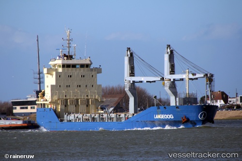
 Langeoog
Current Status
Where is the vessel?
Langeoog is currently in 163 nm NE of Enmore, based on AIS data received about 14h ago.
Latest AIS update:
Current position: 8.91268° N, 56.30529° W (163 nm NE of Enmore)
Average speed (last 7 days): Loading…
Average speed (last 30 days): Loading…
Vessel profile: Langeoog is a Multi Purpose Carrier with dimensions 108m x 16m.
This page combines live AIS, route history, probable destination signals, nearby traffic, and port activity for practical vessel monitoring.
The current position of vessel Langeoog is 8.91268 lat / -56.30529 lng. Updated: 2026-05-22 04:18:59 UTCNearest reference points:
- 57 nm NE of Adventure
Currently sailing under the flag of Antigua Barbuda ![]()
Details:
Live Vessel Langeoog Analytics (details, animations, etc.)
Recent AIS points (UTC):
2026-05-22 01:30:40 UTC · 9.09437, -56.60010 · SOG 7 kn · COG 109°2026-05-22 01:45:52 UTC · 9.07864, -56.57384 · SOG 7.1 kn · COG 109°
2026-05-22 04:10:43 UTC · 8.92068, -56.32060 · SOG 7.5 kn · COG 105°
2026-05-22 04:18:59 UTC · 8.91268, -56.30529 · SOG 7.4 kn · COG 106°