 Al Safliya
Current Status
Where is the vessel?
Al Safliya is currently in Near Hackberry, based on AIS data received about 14h ago.
Latest AIS update:
Current position: 30.03779° N, 93.33338° W (Near Hackberry)
Average speed (last 7 days): Loading…
Average speed (last 30 days): Loading…
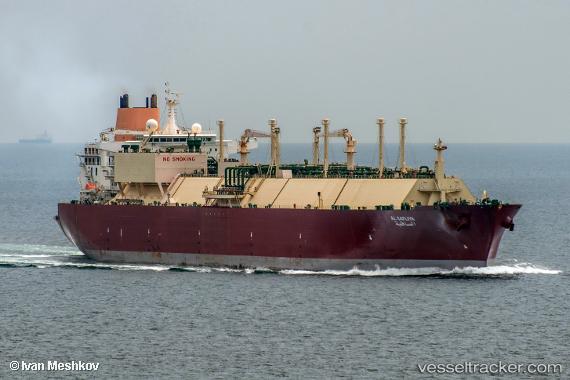
Vessel profile: Al Safliya is a Lng Tanker with dimensions 315m x 50m.
This page combines live AIS, route history, probable destination signals, nearby traffic, and port activity for practical vessel monitoring.
The current position of vessel Al Safliya is 30.03779 lat / -93.33338 lng. Updated: 2026-05-22 20:01:20 UTCNearest reference points:
- Near Carlyss
- Near Lake Charles
- Near Atreco
Currently sailing under the flag of Bahamas ![]()
Al Safliya built in 2007 year
Deadweight:
121963 tDetails:
Live Vessel Al Safliya Analytics (details, animations, etc.)
Recent AIS points (UTC):
2026-05-22 16:51:20 UTC · 30.03780, -93.33336 · SOG 0 kn · COG -1°2026-05-22 18:01:08 UTC · 30.03778, -93.33338 · SOG 0 kn · COG -1°
2026-05-22 19:26:16 UTC · 30.03780, -93.33335 · SOG 0 kn · COG -1°
2026-05-22 20:01:20 UTC · 30.03779, -93.33338 · SOG 0 kn · COG -1°