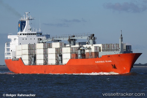
Albemarle Island
Current StatusWhere is the vessel?
Albemarle Island is currently in 83 nm N of Langa de Duero, based on AIS data received about 14h ago.
Latest AIS update:
Current position: 42.97830° N, 32.92819° W (83 nm N of Langa de Duero)
Average speed (last 7 days): Loading…
Average speed (last 30 days): Loading…
Vessel profile: Albemarle Island is a Refrigerated Cargo Ship with dimensions 26m x 180m.
This page combines live AIS, route history, probable destination signals, nearby traffic, and port activity for practical vessel monitoring.
The current position of vessel Albemarle Island is 42.97830 lat / -32.92819 lng. Updated: 2026-05-21 07:45:04 UTCNearest reference points:
- 165 nm N of Villagonzalo Pedernales
Details:
Live Vessel Albemarle Island Analytics (details, animations, etc.)
Recent AIS points (UTC):
2026-05-21 04:26:25 UTC · 42.52920, -34.04612 · SOG 16.8 kn · COG 58°2026-05-21 05:47:25 UTC · 42.71841, -33.59972 · SOG 16.9 kn · COG 56°
2026-05-21 07:19:07 UTC · 42.91685, -33.07634 · SOG 17.3 kn · COG 56°
2026-05-21 07:45:04 UTC · 42.97830, -32.92819 · SOG 17.5 kn · COG 58°