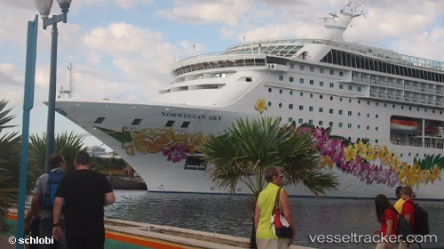
Norwegian Sky
Current StatusWhere is the vessel?
Norwegian Sky is currently in Near Ahoghill, based on AIS data received about 15h ago.
Latest AIS update:
Current position: 55.39018° N, 6.43064° W (Near Ahoghill)
Average speed (last 7 days): Loading…
Average speed (last 30 days): Loading…
Vessel profile: Norwegian Sky is a Cruise Ship with dimensions 32m x 259m.
This page combines live AIS, route history, probable destination signals, nearby traffic, and port activity for practical vessel monitoring.
The current position of vessel Norwegian Sky is 55.39018 lat / -6.43064 lng. Updated: 2026-05-22 23:49:32 UTCNearest reference points:
- Near Belfast
- Near Campbeltown
- Near Southend
Details:
Live Vessel Norwegian Sky Analytics (details, animations, etc.)
Recent AIS points (UTC):
2026-05-22 20:23:22 UTC · 55.79956, -7.03991 · SOG 9.4 kn · COG 160°2026-05-22 22:13:02 UTC · 55.53222, -6.82960 · SOG 9.2 kn · COG 159°
2026-05-22 22:35:21 UTC · 55.47968, -6.78836 · SOG 9.3 kn · COG 164°
2026-05-22 23:49:32 UTC · 55.39018, -6.43064 · SOG 12 kn · COG 105°