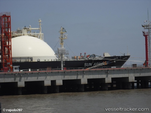
Sun Arrows
Current StatusWhere is the vessel?
Sun Arrows is currently in 35 nm E of Slipi, based on AIS data received about 14h ago.
Latest AIS update:
Current position: 5.96333° N, 107.32395° E (35 nm E of Slipi)
Average speed (last 7 days): Loading…
Average speed (last 30 days): Loading…
Vessel profile: Sun Arrows is a Lng Tanker with dimensions 28m x 151m.
This page combines live AIS, route history, probable destination signals, nearby traffic, and port activity for practical vessel monitoring.
The current position of vessel Sun Arrows is 5.96333 lat / 107.32395 lng. Updated: 2026-05-18 18:07:40 UTCNearest reference points:
- 36 nm SW of Slipi
- 46 nm E of Kakap Natuna Terminal
- 45 nm E of Kakap Natuna Terminal
Details:
Live Vessel Sun Arrows Analytics (details, animations, etc.)
Recent AIS points (UTC):
2026-05-18 14:15:27 UTC · 5.57158, 106.94452 · SOG 9.6 kn · COG -1°2026-05-18 15:55:36 UTC · 5.77889, 107.12322 · SOG 9.8 kn · COG -1°
2026-05-18 15:55:36 UTC · 5.77889, 107.12322 · SOG 9.8 kn · COG -1°
2026-05-18 18:07:40 UTC · 5.96333, 107.32395 · SOG 8.6 kn · COG 226°