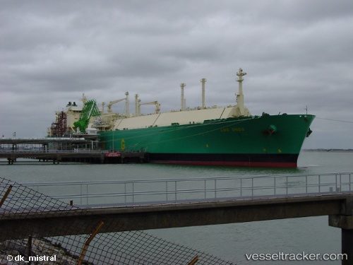
.
Vessel photo of Lng Ondo (IMO 9311579) vesseltracker.com

BM flag Lng Ondo

Vessel type: Lng Tanker | IMO: 9311579 | MMSI: MMSI: 310550000
Call sign: ZCDT5 | Dimensions: 288 m x 43 m
Current Status

Where is the vessel?

Lng Ondo is currently in Open sea, approx. 424 nm off the nearest listed port, based on AIS data received about 14h ago.

Latest AIS update:

Current position: 10.75333° S, 5.05833° E (Open sea, approx. 424 nm off the nearest listed port)

Average speed (last 7 days): Loading…

Average speed (last 30 days): Loading…

Vessel profile: Lng Ondo is a Lng Tanker with dimensions 288m x 43m.

This page combines live AIS, route history, probable destination signals, nearby traffic, and port activity for practical vessel monitoring.

The current position of vessel Lng Ondo is -10.75333 lat / 5.05833 lng. Updated: 2026-05-18 03:41:56 UTC
More recent position available: 49 min ago
Free positions are delayed by 14 hours.

We recommend registering. If you register, paid vessel access will be saved in your profile. Guest access works only through a personal link.

Nearest reference points:
  • Open sea, approx. 424 nm off the nearest listed port
  • Open sea, approx. 423 nm off the nearest listed port
  • Open sea, approx. 422 nm off the nearest listed port

Currently sailing under the flag of Bermuda BM flag

Lng Ondo built in 2007 year

Deadweight:
83688 t

Details:

Live Vessel Lng Ondo Analytics (details, animations, etc.)


Recent AIS points (UTC):
2026-05-17 23:22:14 UTC · -11.38929, 5.24723 · SOG 9.1 kn · COG 342°
2026-05-18 01:45:35 UTC · -11.03743, 5.14523 · SOG 9.2 kn · COG 343°
2026-05-18 02:06:38 UTC · -10.98694, 5.12952 · SOG 9.1 kn · COG 342°
2026-05-18 03:41:56 UTC · -10.75333, 5.05833 · SOG 9 kn · COG -1°

UTC: --
Start: -- Track timeline (UTC) End: --
Encountered: --


Link to the map:


Find another ship

Lng_Ondo (310550000) last ports (portcalls and passsages)

Fateh Terminal | 2025-08-21 23:24:10
AL KHIRAN | 2025-08-18 21:38:19
Mina Saud | 2025-08-18 20:29:47
Port Elizabeth | 2025-07-31 07:16:08
Bonny | 2025-07-18 22:18:56
Huelva | 2025-05-26 12:52:49
Bonny | 2025-05-09 09:34:28
EL CHORRILLO | 2025-04-08 08:11:25
Huelva | 2025-02-02 16:42:49
Bonny | 2025-01-20 15:24:12
Strait Of Gibraltar | 2024-12-18 22:53:32
TARIFA | 2024-12-18 21:33:18
SAINT LOUIS DU RHONE | 2024-12-15 08:18:38
LAVERA | 2024-12-15 07:26:23
TANGER MED | 2024-12-13 00:37:20
Strait Of Gibraltar | 2024-12-13 00:24:14
Bonny | 2024-12-01 23:26:11
Bonny | 2024-10-25 23:18:26
Fateh Terminal | 2024-09-21 23:07:16
Mina Saud | 2024-09-18 21:42:05
Bonny | 2024-08-15 08:56:34
Durban | 2024-08-03 09:15:24
Muhammad Bin Qasim | 2024-07-14 05:03:27
Port Elizabeth | 2024-06-29 06:03:55
Bonny | 2024-06-17 12:26:34
Port Louis | 2024-06-03 05:55:35
Port Elizabeth | 2024-04-30 11:45:40
Bonny | 2024-04-20 09:40:10
Singapore | 2024-02-16 07:01:42
Map Ta Phut | 2024-02-11 00:02:11
Sambu | 2024-02-06 00:30:23
Bonny | 2024-01-08 20:43:33
Muhammad Bin Qasim | 2023-12-02 07:18:50
Bonny | 2023-11-11 10:02:20
Singapore | 2023-10-19 23:04:21
Sambu | 2023-10-05 03:30:37
Port Louis | 2023-09-26 05:33:48
Bonny | 2023-09-12 10:17:15
La Coruna | 2023-08-24 08:58:46
Ferrol | 2023-08-23 06:24:40
Bonny | 2023-08-02 23:42:21
Bonny | 2023-05-28 08:48:01
Bonny | 2023-04-18 09:23:06
Huelva | 2023-03-29 08:14:48
Bonny | 2023-03-15 17:35:48
Cartagena | 2023-02-14 08:08:13
Bonny | 2023-01-27 20:02:39
Bonny | 2022-12-04 23:55:01
Port Elizabeth | 2022-11-21 08:18:17
Port Louis | 2022-11-12 05:20:51
Port Elizabeth | 2022-08-26 07:15:45
Bonny | 2022-08-16 19:40:52
Singapore | 2022-07-25 07:37:11
Bonny | 2022-06-18 14:03:55
St. Nazaire | 2022-05-17 05:08:15
Bonny | 2022-05-04 13:52:30
Port Elizabeth | 2022-04-04 12:35:06
Bonny | 2022-02-21 04:10:07
Huelva | 2022-02-08 07:45:08
Bonny | 2022-01-28 20:30:00
Port Des Galets | 2022-01-15 04:50:08
Singapore | 2022-01-03 04:15:48
Singapore | 2022-01-03 03:40:59
Sambu | 2022-01-03 03:25:07
Singapore | 2021-12-16 05:58:56