 Lng Port harcourt Ii
Current Status
Where is the vessel?
Lng Port harcourt Ii is currently in 160 nm SW of Monrovia, based on AIS data received about 15h ago.
Latest AIS update:
Current position: 4.03439° N, 12.17846° W (160 nm SW of Monrovia)
Average speed (last 7 days): Loading…
Average speed (last 30 days): Loading…
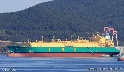
Vessel profile: Lng Port harcourt Ii is a Lng Tanker with dimensions 292m x 292m.
This page combines live AIS, route history, probable destination signals, nearby traffic, and port activity for practical vessel monitoring.
The current position of vessel Lng Port harcourt Ii is 4.03439 lat / -12.17846 lng. Updated: 2026-05-23 01:38:03 UTCNearest reference points:
- 110 nm SW of River Cess
- 126 nm SW of YORK
- 15 nm SW of Buchanan
Currently sailing under the flag of Bermuda ![]()
Details:
Live Vessel Lng Port harcourt Ii Analytics (details, animations, etc.)
Recent AIS points (UTC):
2026-05-22 22:32:57 UTC · 3.58038, -11.50418 · SOG 16 kn · COG 303°2026-05-22 23:43:20 UTC · 3.75510, -11.76304 · SOG 15.8 kn · COG 304°
2026-05-23 01:34:22 UTC · 4.02552, -12.16530 · SOG 15.4 kn · COG 304°
2026-05-23 01:38:03 UTC · 4.03439, -12.17846 · SOG 15.4 kn · COG 303°