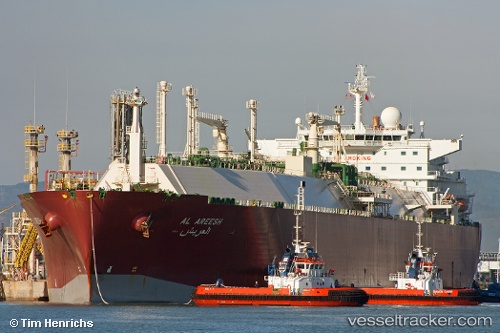
Al Areesh
Current StatusWhere is the vessel?
Al Areesh is currently in 184 nm W of Marmagao (Marmugao), based on AIS data received about 14h ago.
Latest AIS update:
Current position: 14.90667° N, 70.64667° E (184 nm W of Marmagao (Marmugao))
Average speed (last 7 days): Loading…
Average speed (last 30 days): Loading…
Vessel profile: Al Areesh is a Lng Tanker with dimensions 44m x 288m.
This page combines live AIS, route history, probable destination signals, nearby traffic, and port activity for practical vessel monitoring.
The current position of vessel Al Areesh is 14.90667 lat / 70.64667 lng. Updated: 2026-05-23 06:06:15 UTCNearest reference points:
- 202 nm NW of Amini Island
- 89 nm W of Marmagao (Marmugao)
- 282 nm W of RATNAGIRI
Details:
Live Vessel Al Areesh Analytics (details, animations, etc.)
Recent AIS points (UTC):
2026-05-23 02:36:17 UTC · 14.25500, 70.98167 · SOG 12 kn · COG -1°2026-05-23 03:39:20 UTC · 14.44500, 70.88167 · SOG 12 kn · COG -1°
2026-05-23 03:57:12 UTC · 14.50167, 70.85333 · SOG 12 kn · COG -1°
2026-05-23 06:06:15 UTC · 14.90667, 70.64667 · SOG 12 kn · COG -1°