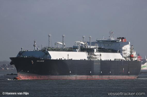
 Malanje
Current Status
Where is the vessel?
Malanje is currently in 107 nm NE of Abakaliki, based on AIS data received about 15h ago.
Latest AIS update:
Current position: 7.84333° N, 86.95667° E (107 nm NE of Abakaliki)
Average speed (last 7 days): Loading…
Average speed (last 30 days): Loading…
Vessel profile: Malanje is a Lng Tanker with dimensions 285m x 44m.
This page combines live AIS, route history, probable destination signals, nearby traffic, and port activity for practical vessel monitoring.
The current position of vessel Malanje is 7.84333 lat / 86.95667 lng. Updated: 2026-05-22 07:45:52 UTCNearest reference points:
- 23 nm S of Abakaliki
- 46 nm SW of Abakaliki
Currently sailing under the flag of Bahamas ![]()
Malanje built in 2011 year
Deadweight:
82728 tDetails:
Live Vessel Malanje Analytics (details, animations, etc.)
Recent AIS points (UTC):
2026-05-22 04:42:47 UTC · 8.32333, 87.60333 · SOG 15 kn · COG -1°2026-05-22 05:27:55 UTC · 8.20667, 87.44167 · SOG 15 kn · COG -1°
2026-05-22 07:21:47 UTC · 7.90667, 87.04167 · SOG 15 kn · COG -1°
2026-05-22 07:45:52 UTC · 7.84333, 86.95667 · SOG 15 kn · COG -1°