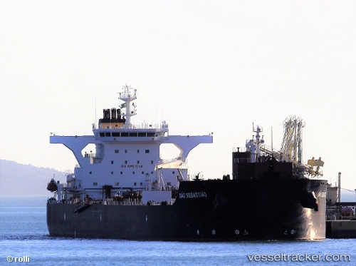
Sao Sebastiao
Current StatusWhere is the vessel?
Sao Sebastiao is currently in 123 nm SE of Alcobaca, based on AIS data received about 15h ago.
Latest AIS update:
Current position: 18.82429° S, 37.54269° W (123 nm SE of Alcobaca)
Average speed (last 7 days): Loading…
Average speed (last 30 days): Loading…
Vessel profile: Sao Sebastiao is a Crude Oil Tanker with dimensions 42m x 245m.
This page combines live AIS, route history, probable destination signals, nearby traffic, and port activity for practical vessel monitoring.
The current position of vessel Sao Sebastiao is -18.82429 lat / -37.54269 lng. Updated: 2026-05-19 11:25:47 UTCNearest reference points:
- 91 nm E of Conceicao da Barra
- 169 nm E of Alcobaca
- 66 nm NE of Espírito Santo FPSO
Details:
Live Vessel Sao Sebastiao Analytics (details, animations, etc.)
Recent AIS points (UTC):
2026-05-19 08:13:16 UTC · -18.23343, -37.20970 · SOG 11.9 kn · COG 207°2026-05-19 09:24:57 UTC · -18.44730, -37.33291 · SOG 12.6 kn · COG 207°
2026-05-19 10:43:18 UTC · -18.69379, -37.46594 · SOG 12.6 kn · COG 213°
2026-05-19 11:25:47 UTC · -18.82429, -37.54269 · SOG 12.5 kn · COG 208°