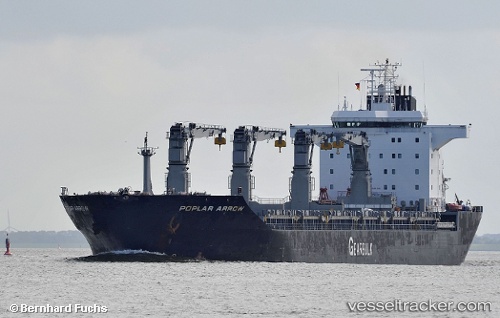
Poplar Arrow
Current StatusWhere is the vessel?
Poplar Arrow is currently in 37 nm NE of MALAHAYATI, based on AIS data received about 1d ago.
Latest AIS update:
Current position: 5.96487° N, 96.02885° E (37 nm NE of MALAHAYATI)
Average speed (last 7 days): Loading…
Average speed (last 30 days): Loading…
Vessel profile: Poplar Arrow is a Multi Purpose Carrier with dimensions 30m x 190m.
This page combines live AIS, route history, probable destination signals, nearby traffic, and port activity for practical vessel monitoring.
The current position of vessel Poplar Arrow is 5.96487 lat / 96.02885 lng. Updated: 2026-05-21 15:06:41 UTCNearest reference points:
- 21 nm N of Sebang
- 53 nm NE of Sebang
- 28 nm NW of Sebang
Details:
Live Vessel Poplar Arrow Analytics (details, animations, etc.)
Recent AIS points (UTC):
2026-05-21 15:06:41 UTC · 5.96487, 96.02885 · SOG 13.4 kn · COG 285°2026-05-21 15:06:41 UTC · 5.96487, 96.02885 · SOG 13.4 kn · COG 285°
2026-05-21 15:06:41 UTC · 5.96487, 96.02885 · SOG 13.4 kn · COG 285°
2026-05-21 15:06:41 UTC · 5.96487, 96.02885 · SOG 13.4 kn · COG 285°