 TRUE BROTHER
Current Status
Where is the vessel?
TRUE BROTHER is currently in Near Port Raysut, based on AIS data received about 15h ago.
Latest AIS update:
Current position: 16.94167° N, 54.02017° E (Near Port Raysut)
Average speed (last 7 days): Loading…
Average speed (last 30 days): Loading…
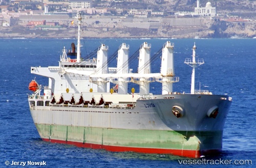
Vessel profile: TRUE BROTHER is a Bulk Carrier with dimensions 29m x 177m.
This page combines live AIS, route history, probable destination signals, nearby traffic, and port activity for practical vessel monitoring.
The current position of vessel TRUE BROTHER is 16.94167 lat / 54.02017 lng. Updated: 2026-05-18 22:25:28 UTCNearest reference points:
- 103 nm S of Port Raysut
- 106 nm S of Port Raysut
- 110 nm NE of Gross Koris
Currently sailing under the flag of Barbados ![]()
TRUE BROTHER built in 2001 year
Deadweight:
31812 tDetails:
Live Vessel TRUE BROTHER Analytics (details, animations, etc.)
Recent AIS points (UTC):
2026-05-18 19:14:37 UTC · 16.94167, 54.02017 · SOG 0 kn · COG -1°2026-05-18 19:44:42 UTC · 16.94151, 54.01998 · SOG 0.3 kn · COG -1°
2026-05-18 22:00:23 UTC · 16.94167, 54.02017 · SOG 0 kn · COG -1°
2026-05-18 22:25:28 UTC · 16.94167, 54.02017 · SOG 0 kn · COG -1°