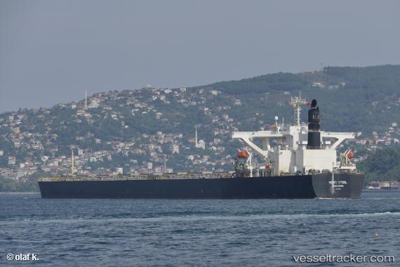
.
Vessel photo of MEGA (IMO 9406518) vesseltracker.com

PA flag MEGA

Vessel type: Bulk Carrier | IMO: 9406518 | MMSI: MMSI: 352001964
Call sign: 3E2804 | Dimensions: 45 m x 289 m
Current Status

Where is the vessel?

MEGA is currently in 35 nm SW of Cape Of Good Hope, based on AIS data received about 14h ago.

Latest AIS update:

Current position: 34.82193° S, 17.94399° E (35 nm SW of Cape Of Good Hope)

Average speed (last 7 days): Loading…

Average speed (last 30 days): Loading…

Vessel profile: MEGA is a Bulk Carrier with dimensions 45m x 289m.

This page combines live AIS, route history, probable destination signals, nearby traffic, and port activity for practical vessel monitoring.

The current position of vessel MEGA is -34.82193 lat / 17.94399 lng. Updated: 2026-05-18 07:49:58 UTC
More recent position available: 44 min ago
Free positions are delayed by 14 hours.

We recommend registering. If you register, paid vessel access will be saved in your profile. Guest access works only through a personal link.

Nearest reference points:
  • 18 nm SW of Cape Of Good Hope
  • Near HOUT BAY
  • 15 nm SE of Moorreesburg

Currently sailing under the flag of Panama PA flag

MEGA built in 2007 year

Deadweight:
180230 t

Details:

Live Vessel MEGA Analytics (details, animations, etc.)


Recent AIS points (UTC):
2026-05-18 04:48:19 UTC · -34.59531, 17.41308 · SOG 9.8 kn · COG 112°
2026-05-18 05:20:41 UTC · -34.63081, 17.51224 · SOG 9.8 kn · COG 112°
2026-05-18 07:37:57 UTC · -34.80611, 17.90977 · SOG 9.7 kn · COG 117°
2026-05-18 07:49:58 UTC · -34.82193, 17.94399 · SOG 9.6 kn · COG 117°

UTC: --
Start: -- Track timeline (UTC) End: --
Encountered: --


Link to the map:


Find another ship

MEGA (352001964) last ports (portcalls and passsages)

Richards Bay | 2025-08-30 14:24:35
Richards Bay | 2025-08-25 17:39:52
Trincomalee | 2025-08-09 22:22:00
Krishnapatnam | 2025-08-07 18:55:56
Krishnapatnam | 2025-08-03 18:13:38
Port Louis | 2025-07-21 13:29:13
JURONG ISLAND | 2025-04-18 11:02:26
PULAU SAMBU | 2025-04-18 09:51:15
TANAH MERAH | 2025-04-18 00:18:01
TANAH MERAH | 2025-04-13 23:30:00
BATU AMPAR | 2025-04-10 00:14:08
TANAH MERAH | 2025-04-09 22:56:36
PENGERANG | 2025-04-09 21:18:06
TAEAN-GUN | 2025-03-28 07:17:26
TAEAN-GUN | 2025-03-24 07:08:36
TAEAN-GUN | 2025-03-20 05:15:25
TAEAN-GUN | 2025-03-16 05:14:05
TAEAN-GUN | 2025-03-12 04:55:47
TAEAN-GUN | 2025-03-08 04:22:00
TAEAN-GUN | 2025-03-04 03:47:13
PENGERANG | 2025-01-22 17:11:41
TANAH MERAH | 2025-01-22 00:15:29
BATU AMPAR | 2025-01-21 23:26:39
PULAU SAMBU | 2025-01-21 22:10:15
POINT LISAS | 2024-12-05 02:14:12
Brighton | 2024-12-04 19:22:31
Santa Marta | 2024-11-26 15:28:11
Oranjestad | 2024-11-25 13:02:21
Sint Nicolaashaven | 2024-11-25 12:25:38
Singapore | 2024-09-27 12:03:13
Vanino | 2024-08-23 05:00:18
Singapore | 2024-07-17 01:16:14
Port Louis | 2024-07-02 00:42:31
Willemstad | 2024-05-02 18:16:10
Ta-Ku | 2024-02-19 07:19:13
Dagu Bar | 2024-02-19 04:45:34
Sambu | 2024-02-06 09:10:07
Singapore | 2023-11-23 07:21:39
Willemstad | 2023-09-30 10:16:47
Sambu | 2023-07-06 00:35:10
Lianyungang | 2023-01-06 20:07:02