 SEAPOWER II
Current Status
Where is the vessel?
SEAPOWER II is currently in 13 nm SE of Kavkaz, based on AIS data received about 1d ago.
Latest AIS update:
Current position: 45.31842° N, 37.04306° E (13 nm SE of Kavkaz)
Average speed (last 7 days): Loading…
Average speed (last 30 days): Loading…
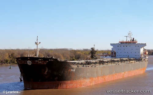
Vessel profile: SEAPOWER II is a Bulk Carrier with dimensions m x m.
This page combines live AIS, route history, probable destination signals, nearby traffic, and port activity for practical vessel monitoring.
The current position of vessel SEAPOWER II is 45.31842 lat / 37.04306 lng. Updated: 2026-05-20 11:30:32 UTCNearest reference points:
- Near Temryuk
- Near Kavkaz
- 13 nm N of Kavkaz
Currently sailing under the flag of Panama ![]()
Details:
Live Vessel SEAPOWER II Analytics (details, animations, etc.)
Recent AIS points (UTC):
2026-05-20 11:30:32 UTC · 45.31842, 37.04306 · SOG 0 kn · COG -1°2026-05-20 11:30:32 UTC · 45.31842, 37.04306 · SOG 0 kn · COG -1°
2026-05-20 11:30:32 UTC · 45.31842, 37.04306 · SOG 0 kn · COG -1°
2026-05-20 11:30:32 UTC · 45.31842, 37.04306 · SOG 0 kn · COG -1°