 TONG DE 188
Current Status
Where is the vessel?
TONG DE 188 is currently in Near Ky Ha Terminal, based on AIS data received about 16h ago.
Latest AIS update:
Current position: 15.48292° N, 108.76408° E (Near Ky Ha Terminal)
Average speed (last 7 days): Loading…
Average speed (last 30 days): Loading…
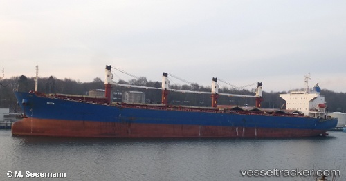
Vessel profile: TONG DE 188 is a Bulk Carrier with dimensions m x m.
This page combines live AIS, route history, probable destination signals, nearby traffic, and port activity for practical vessel monitoring.
The current position of vessel TONG DE 188 is 15.48292 lat / 108.76408 lng. Updated: 2026-05-19 07:26:25 UTCNearest reference points:
- Near DUNG QUAT
- Near Thuan An
- 23 nm E of Hai Son
Currently sailing under the flag of Panama ![]()
Details:
Live Vessel TONG DE 188 Analytics (details, animations, etc.)
Recent AIS points (UTC):
2026-05-19 04:05:26 UTC · 15.48349, 108.76599 · SOG 0.4 kn · COG 152°2026-05-19 05:26:25 UTC · 15.48263, 108.76457 · SOG 0 kn · COG 107°
2026-05-19 07:11:27 UTC · 15.48299, 108.76415 · SOG 0.1 kn · COG 115°
2026-05-19 07:26:25 UTC · 15.48292, 108.76408 · SOG 0.1 kn · COG 108°