 SEA ROCK
Current Status
Where is the vessel?
SEA ROCK is currently in 48 nm SE of OSMAN DIGNA, based on AIS data received about 14d ago.
Latest AIS update:
Current position: 18.63965° N, 38.01877° E (48 nm SE of OSMAN DIGNA)
Average speed (last 7 days): Loading…
Average speed (last 30 days): Loading…
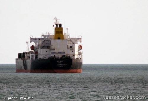
Vessel profile: SEA ROCK is a Oil Products Tanker with dimensions m x m.
This page combines live AIS, route history, probable destination signals, nearby traffic, and port activity for practical vessel monitoring.
The current position of vessel SEA ROCK is 18.63965 lat / 38.01877 lng. Updated: 2026-05-04 18:39:19 UTCNearest reference points:
- Near Port Sudan
- 99 nm SW of Al Qunfudah
- 53 nm SW of SHUAIBAH
Currently sailing under the flag of Panama ![]()
Details:
Live Vessel SEA ROCK Analytics (details, animations, etc.)
Recent AIS points (UTC):
2026-05-04 18:39:19 UTC · 18.63965, 38.01877 · SOG 9.7 kn · COG 0°2026-05-04 18:39:19 UTC · 18.63965, 38.01877 · SOG 9.7 kn · COG 0°
2026-05-04 18:39:19 UTC · 18.63965, 38.01877 · SOG 9.7 kn · COG 0°
2026-05-04 18:39:19 UTC · 18.63965, 38.01877 · SOG 9.7 kn · COG 0°