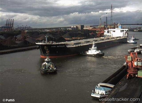
 Cape Mathilde
Current Status
Where is the vessel?
Cape Mathilde is currently in 22 nm NW of LINKOU, based on AIS data received about 615d ago.
Latest AIS update:
Current position: 25.45593° N, 121.11337° E (22 nm NW of LINKOU)
Average speed (last 7 days): Loading…
Average speed (last 30 days): Loading…
Vessel profile: Cape Mathilde is a Ore Carrier with dimensions 292m x 45m.
This page combines live AIS, route history, probable destination signals, nearby traffic, and port activity for practical vessel monitoring.
The current position of vessel Cape Mathilde is 25.45593 lat / 121.11337 lng. Updated: 2024-09-12 08:20:00 UTCNearest reference points:
- Near Sha-lun
- Near Bali
- 11 nm NE of Bali
Currently sailing under the flag of Panama ![]()
Cape Mathilde built in 2010 year
Deadweight:
178831 tDetails:
Live Vessel Cape Mathilde Analytics (details, animations, etc.)
Recent AIS points (UTC):
2024-09-12 08:20:00 UTC · 25.45593, 121.11337 · SOG 11.7 kn · COG 34° · DEST QINGDAO