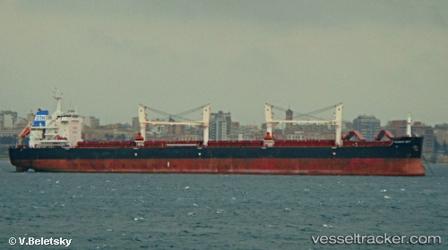
Clear Sky
Current StatusWhere is the vessel?
Clear Sky is currently in 55 nm SE of Nedroma, based on AIS data received about 16h ago.
Latest AIS update:
Current position: 34.29123° N, 13.95105° W (55 nm SE of Nedroma)
Average speed (last 7 days): Loading…
Average speed (last 30 days): Loading…
Vessel profile: Clear Sky is a Bulk Carrier with dimensions 32m x 200m.
This page combines live AIS, route history, probable destination signals, nearby traffic, and port activity for practical vessel monitoring.
The current position of vessel Clear Sky is 34.29123 lat / -13.95105 lng. Updated: 2026-05-23 07:36:34 UTCNearest reference points:
- 104 nm W of Jarjis
- 109 nm E of Porto Santo Island
- 75 nm NE of Nedroma
Details:
Live Vessel Clear Sky Analytics (details, animations, etc.)
Recent AIS points (UTC):
2026-05-23 04:27:28 UTC · 33.78923, -14.02735 · SOG 9.7 kn · COG 6°2026-05-23 05:27:02 UTC · 33.94803, -14.00578 · SOG 9.5 kn · COG 8°
2026-05-23 07:36:34 UTC · 34.29123, -13.95105 · SOG 9.6 kn · COG 6°
2026-05-23 07:36:34 UTC · 34.29123, -13.95105 · SOG 9.6 kn · COG 6°