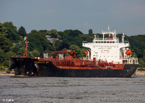
Chemroute Sky
Current StatusWhere is the vessel?
Chemroute Sky is currently in 15 nm W of HNB SEZ/Mumbai, based on AIS data received about 14h ago.
Latest AIS update:
Current position: 19.04693° N, 72.57077° E (15 nm W of HNB SEZ/Mumbai)
Average speed (last 7 days): Loading…
Average speed (last 30 days): Loading…
Vessel profile: Chemroute Sky is a Chemical Oil Products Tanker with dimensions 26m x 156m.
This page combines live AIS, route history, probable destination signals, nearby traffic, and port activity for practical vessel monitoring.
The current position of vessel Chemroute Sky is 19.04693 lat / 72.57077 lng. Updated: 2026-05-19 13:26:36 UTCNearest reference points:
- Near HNB SEZ/Mumbai
- Near Mumbai
- Near NHAVA SHEVA
Details:
Live Vessel Chemroute Sky Analytics (details, animations, etc.)
Recent AIS points (UTC):
2026-05-19 10:19:21 UTC · 19.04828, 72.57305 · SOG 0.2 kn · COG 287°2026-05-19 11:51:13 UTC · 19.04712, 72.57078 · SOG 0.2 kn · COG -1°
2026-05-19 13:21:21 UTC · 19.04700, 72.57072 · SOG 0.1 kn · COG -1°
2026-05-19 13:26:36 UTC · 19.04693, 72.57077 · SOG 0.1 kn · COG -1°