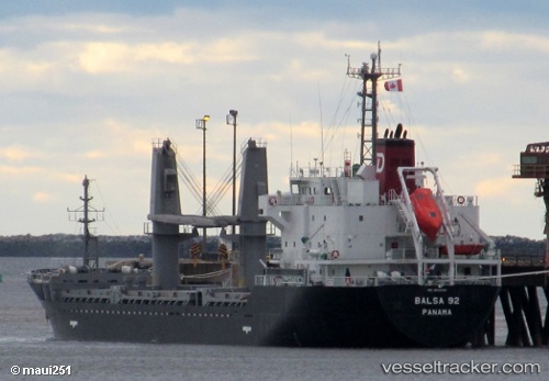
 Balsa 92
Current Status
Where is the vessel?
Balsa 92 is currently in Near Hampton Roads, based on AIS data received about 14h ago.
Latest AIS update:
Current position: 36.94405° N, 76.37287° W (Near Hampton Roads)
Average speed (last 7 days): Loading…
Average speed (last 30 days): Loading…
Vessel profile: Balsa 92 is a General Cargo Ship with dimensions 106m x 106m.
This page combines live AIS, route history, probable destination signals, nearby traffic, and port activity for practical vessel monitoring.
The current position of vessel Balsa 92 is 36.94405 lat / -76.37287 lng. Updated: 2026-05-20 14:03:19 UTCNearest reference points:
- Near Sewell's Point
- Near Newport News
- Near Hampton Roads Pt
Currently sailing under the flag of Panama ![]()
Balsa 92 built in 2013 year
Deadweight:
7733 tDetails:
Live Vessel Balsa 92 Analytics (details, animations, etc.)
Recent AIS points (UTC):
2026-05-20 10:22:39 UTC · 36.77851, -75.67342 · SOG 11.8 kn · COG 313°2026-05-20 12:19:39 UTC · 36.94510, -76.00271 · SOG 9.6 kn · COG 295°
2026-05-20 13:26:08 UTC · 37.00734, -76.24671 · SOG 11.6 kn · COG 273°
2026-05-20 14:03:19 UTC · 36.94405, -76.37287 · SOG 6.8 kn · COG 235°