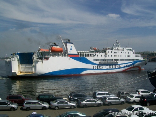
 Eastern Dream
Current Status
Where is the vessel?
Eastern Dream is currently in Near SAKAIMINATO, based on AIS data received about 14h ago.
Latest AIS update:
Current position: 35.52264° N, 133.25934° E (Near SAKAIMINATO)
Average speed (last 7 days): Loading…
Average speed (last 30 days): Loading…
Vessel profile: Eastern Dream is a Passenger Ro Ro Cargo Ship with dimensions 140m x 20m.
This page combines live AIS, route history, probable destination signals, nearby traffic, and port activity for practical vessel monitoring.
The current position of vessel Eastern Dream is 35.52264 lat / 133.25934 lng. Updated: 2026-05-22 07:19:03 UTCNearest reference points:
- Near FUKUYAMA
- Near Kurashiki
- Near MIZUSHIMA
Currently sailing under the flag of Panama ![]()
Eastern Dream built in 1993 year
Deadweight:
1300 tDetails:
Live Vessel Eastern Dream Analytics (details, animations, etc.)
Recent AIS points (UTC):
2026-05-22 03:22:07 UTC · 35.52262, 133.25935 · SOG 0 kn · COG 156°2026-05-22 05:01:07 UTC · 35.52264, 133.25937 · SOG 0 kn · COG 156°
2026-05-22 06:28:07 UTC · 35.52266, 133.25935 · SOG 0 kn · COG 156°
2026-05-22 07:19:03 UTC · 35.52264, 133.25934 · SOG 0 kn · COG 156°