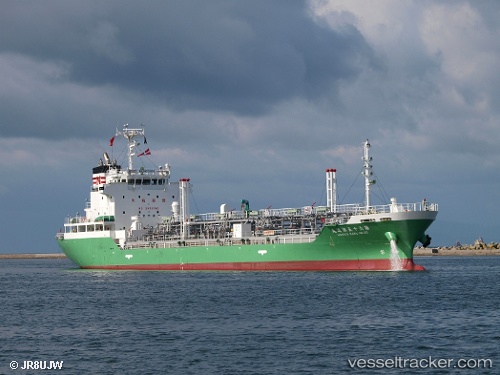
 NANIWA MARU NO. 65
Current Status
Where is the vessel?
NANIWA MARU NO. 65 is currently in 11 nm S of Kosai-Shi, based on AIS data received about 14h ago.
Latest AIS update:
Current position: 34.53504° N, 137.53935° E (11 nm S of Kosai-Shi)
Average speed (last 7 days): Loading…
Average speed (last 30 days): Loading…
Vessel profile: NANIWA MARU NO. 65 is a Oil Products Tanker with dimensions m x m.
This page combines live AIS, route history, probable destination signals, nearby traffic, and port activity for practical vessel monitoring.
The current position of vessel NANIWA MARU NO. 65 is 34.53504 lat / 137.53935 lng. Updated: 2026-05-23 07:04:52 UTCNearest reference points:
- 17 nm S of TOYOHASHI
- Near TOYOHASHI
- 12 nm E of TOBA
Currently sailing under the flag of Japan ![]()
NANIWA MARU NO. 65 built in 2008 year
Deadweight:
4999 tDetails:
Live Vessel NANIWA MARU NO. 65 Analytics (details, animations, etc.)
Recent AIS points (UTC):
2026-05-23 04:14:54 UTC · 34.65167, 136.85834 · SOG 14 kn · COG -1°2026-05-23 04:43:11 UTC · 34.58446, 136.96500 · SOG 13.8 kn · COG 122°
2026-05-23 06:12:32 UTC · 34.52993, 137.31720 · SOG 12.1 kn · COG 86°
2026-05-23 07:04:52 UTC · 34.53504, 137.53935 · SOG 13.1 kn · COG 88°