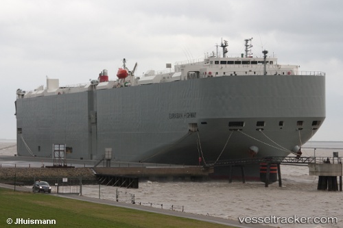
 Eurasian Highway
Current Status
Where is the vessel?
Eurasian Highway is currently in 40 nm W of Santa Venera, based on AIS data received about 14h ago.
Latest AIS update:
Current position: 35.77562° N, 142.57881° E (40 nm W of Santa Venera)
Average speed (last 7 days): Loading…
Average speed (last 30 days): Loading…
Vessel profile: Eurasian Highway is a Vehicles Carrier with dimensions 199m x 32m.
This page combines live AIS, route history, probable destination signals, nearby traffic, and port activity for practical vessel monitoring.
The current position of vessel Eurasian Highway is 35.77562 lat / 142.57881 lng. Updated: 2026-05-23 08:15:56 UTCNearest reference points:
- 37 nm E of ONAHAMA
- 12 nm E of CHOSHI
- 31 nm NE of ONAHAMA
Currently sailing under the flag of Japan ![]()
Eurasian Highway built in 2012 year
Deadweight:
18709 tDetails:
Live Vessel Eurasian Highway Analytics (details, animations, etc.)
Recent AIS points (UTC):
2026-05-23 04:08:20 UTC · 35.27455, 141.33565 · SOG 14.3 kn · COG 64°2026-05-23 06:24:55 UTC · 35.52237, 141.97530 · SOG 18.3 kn · COG 59°
2026-05-23 06:54:50 UTC · 35.59981, 142.13345 · SOG 18.2 kn · COG 66°
2026-05-23 08:15:56 UTC · 35.77562, 142.57881 · SOG 16.9 kn · COG 67°