 TURKESTAN
Current Status
Where is the vessel?
TURKESTAN is currently in 15 nm S of Xirdalan, based on AIS data received about 1d ago.
Latest AIS update:
Current position: 39.99510° N, 49.80176° E (15 nm S of Xirdalan)
Average speed (last 7 days): Loading…
Average speed (last 30 days): Loading…
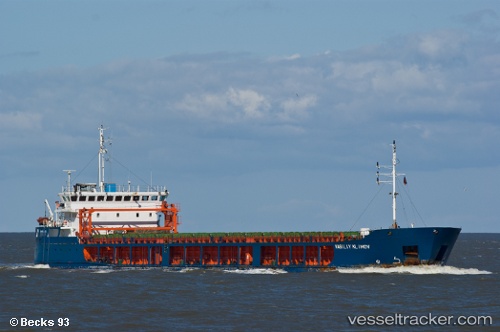
Vessel profile: TURKESTAN is a General Cargo with dimensions 109m x 17m.
This page combines live AIS, route history, probable destination signals, nearby traffic, and port activity for practical vessel monitoring.
The current position of vessel TURKESTAN is 39.99510 lat / 49.80176 lng. Updated: 2026-05-22 15:35:15 UTCNearest reference points:
- Near Khanlar
- Near Qaradag
- 27 nm SE of Heydar Aliyev International Apt.
Currently sailing under the flag of Kazakhstan ![]()
TURKESTAN built in 2007 year
Deadweight:
5471 tDetails:
Live Vessel TURKESTAN Analytics (details, animations, etc.)
Recent AIS points (UTC):
2026-05-22 15:35:15 UTC · 39.99510, 49.80176 · SOG 7.2 kn · COG 226°2026-05-22 15:35:15 UTC · 39.99510, 49.80176 · SOG 7.2 kn · COG 226°
2026-05-22 15:35:15 UTC · 39.99510, 49.80176 · SOG 7.2 kn · COG 226°
2026-05-22 15:35:15 UTC · 39.99510, 49.80176 · SOG 7.2 kn · COG 226°