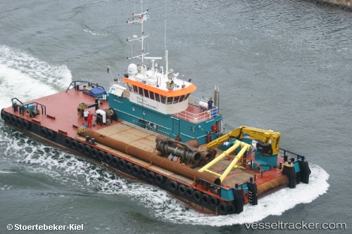
Coastal Discovery
Current StatusWhere is the vessel?
Coastal Discovery is currently in Near Al Hamriyah, based on AIS data received about 1d ago.
Latest AIS update:
Current position: 25.46797° N, 55.50938° E (Near Al Hamriyah)
Average speed (last 7 days): Loading…
Average speed (last 30 days): Loading…
Vessel profile: Coastal Discovery is a Work Repair Vessel with dimensions 12m x 35m.
This page combines live AIS, route history, probable destination signals, nearby traffic, and port activity for practical vessel monitoring.
The current position of vessel Coastal Discovery is 25.46797 lat / 55.50938 lng. Updated: 2026-05-18 20:28:26 UTCNearest reference points:
- Near Al Hamriyah
- Near AJMAN
- Near Sharjah
Details:
Live Vessel Coastal Discovery Analytics (details, animations, etc.)
Recent AIS points (UTC):
2026-05-18 20:28:26 UTC · 25.46797, 55.50938 · SOG 0.1 kn · COG -1°2026-05-18 20:28:26 UTC · 25.46797, 55.50938 · SOG 0.1 kn · COG -1°
2026-05-18 20:28:26 UTC · 25.46797, 55.50938 · SOG 0.1 kn · COG -1°
2026-05-18 20:28:26 UTC · 25.46797, 55.50938 · SOG 0.1 kn · COG -1°