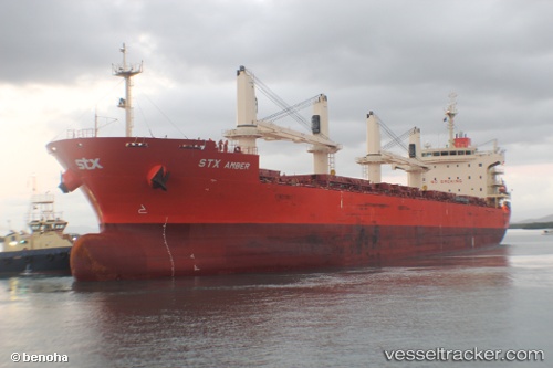
Pan Amber
Current StatusWhere is the vessel?
Pan Amber is currently in 45 nm NW of TANJUNG JATI, based on AIS data received about 14h ago.
Latest AIS update:
Current position: 6.06147° S, 110.07641° E (45 nm NW of TANJUNG JATI)
Average speed (last 7 days): Loading…
Average speed (last 30 days): Loading…
Vessel profile: Pan Amber is a Bulk Carrier with dimensions 30m x 189m.
This page combines live AIS, route history, probable destination signals, nearby traffic, and port activity for practical vessel monitoring.
The current position of vessel Pan Amber is -6.06147 lat / 110.07641 lng. Updated: 2026-05-22 01:10:25 UTCNearest reference points:
- Near Batang
- 26 nm N of Pemalang
- 49 nm NE of TANJUNG JATI
Details:
Live Vessel Pan Amber Analytics (details, animations, etc.)
Recent AIS points (UTC):
2026-05-21 21:22:46 UTC · -5.51817, 109.40691 · SOG 13.9 kn · COG 141°2026-05-21 22:03:17 UTC · -5.62740, 109.51949 · SOG 13.9 kn · COG 133°
2026-05-22 01:10:25 UTC · -6.06147, 110.07641 · SOG 13.2 kn · COG 98°
2026-05-22 01:10:25 UTC · -6.06147, 110.07641 · SOG 13.2 kn · COG 98°