 vesseltracker.com
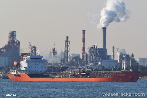
Gloriwind
Current StatusWhere is the vessel?
Gloriwind is currently in 38 nm SE of Vreta Kloster, based on AIS data received about 14h ago.
Latest AIS update:
Current position: 57.94667° N, 151.20833° E (38 nm SE of Vreta Kloster)
Average speed (last 7 days): Loading…
Average speed (last 30 days): Loading…
Vessel profile: Gloriwind is a Oil Products Tanker with dimensions 18m x 115m.
This page combines live AIS, route history, probable destination signals, nearby traffic, and port activity for practical vessel monitoring.
The current position of vessel Gloriwind is 57.94667 lat / 151.20833 lng. Updated: 2026-05-18 02:04:29 UTCNearest reference points:
- 74 nm E of Vreta Kloster
- Near Magadan
Details:
Live Vessel Gloriwind Analytics (details, animations, etc.)
Recent AIS points (UTC):
2026-05-17 21:46:29 UTC · 57.93167, 151.23334 · SOG 0 kn · COG -1°2026-05-17 21:57:48 UTC · 57.93479, 151.23154 · SOG 0.7 kn · COG 267°
2026-05-17 23:56:58 UTC · 57.94677, 151.22153 · SOG 0.2 kn · COG 128°
2026-05-18 02:04:29 UTC · 57.94667, 151.20833 · SOG 0 kn · COG -1°